
Contour Map Drawing Worksheet
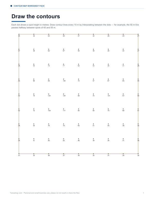
This two-page Letter PDF is for students working with contour maps and spot heights in metres. Each dot shows a spot height, and the task is to draw contour lines every 10 m by interpolating between the dots. One example explains that the 50 m contour runs halfway between 45 m and 55 m spots. An answer key is included, with computer-drawn contours from the same heights.
Free printable · PDF
- 2 pages
- US Letter — choose “Fit to page” for A4
- PDF, 121 KB
Free for personal, family and classroom use.
Use the sheet as a mapping practice page, a class exercise, or a quick check of contour-line understanding. Draw the lines on the map, then compare your work with the answer key. Hand-drawn contours may differ slightly, which is normal when working from the same heights.
Good for
- Contour line practice
- Mapping classwork
- Spot height interpolation
Tip: Print on plain paper first, then trace the contours in pencil for easy corrections.
4 files · PDF, DOCX
Get every sheet: Contour Map Worksheet Pack
This sheet plus 3 more in one download, with the editable Word files. Contour map reading worksheets on three generated terrains with answer keys, a draw-the-contours exercise from spot heights, a topographic profile worksheet and a landform reference sheet.
$5.00 USD, one-time 4 files · about $1.25 each
- Instant download
- 7-day refund
- Secure checkout by Stripe
7-day money-back guarantee. Full refund within 7 days of purchase, even after you download.
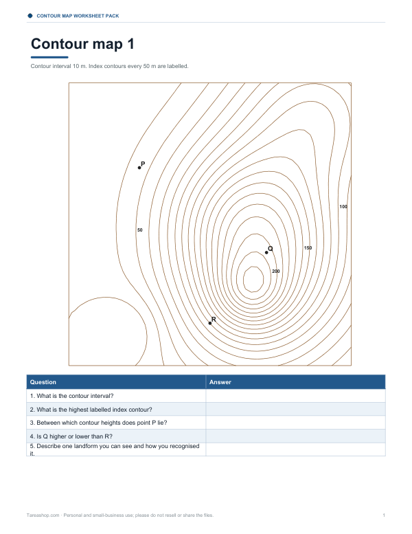 Contour Map Reading Worksheets
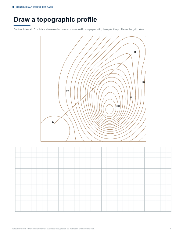 Printable Contour Profile Worksheet
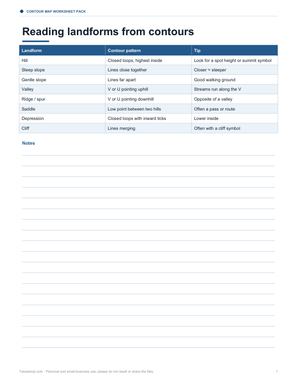 Printable Landform Reference Chart