
Printable Landform Reference Chart
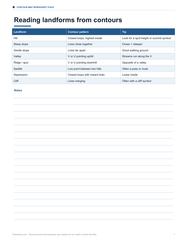
This one-page landform reference sheet is for students, teachers, and anyone learning how to read contour maps. It has a three-column table with Landform, Contour pattern, and Tip. The rows cover Hill with closed loops and the highest point inside, Steep slope with lines close together, and Gentle slope with lines far apart. Each row includes a short clue, such as looking for a spot height or summit symbol, noticing that closer lines mean steeper ground, and seeing that wide spacing usually means easier walking ground.
Free printable · PDF
- 1 page
- US Letter — choose “Fit to page” for A4
- PDF, 97 KB
Free for personal, family and classroom use.
Use it as a quick class reference, a map study aid, or a partner page with contour map practice. Read across each row to match the landform name with its contour pattern and tip, then compare the patterns to real map features. Keep it beside a worksheet when identifying hills and slopes.
Good for
- Contour map lesson reference
- Map reading practice support
- Quick study guide for landforms
Tip: Print it single-sided and keep it with contour map worksheets for easy review.
4 files · PDF, DOCX
Get every sheet: Contour Map Worksheet Pack
This sheet plus 3 more in one download, with the editable Word files. Contour map reading worksheets on three generated terrains with answer keys, a draw-the-contours exercise from spot heights, a topographic profile worksheet and a landform reference sheet.
$5.00 USD, one-time 4 files · about $1.25 each
- Instant download
- 7-day refund
- Secure checkout by Stripe
7-day money-back guarantee. Full refund within 7 days of purchase, even after you download.
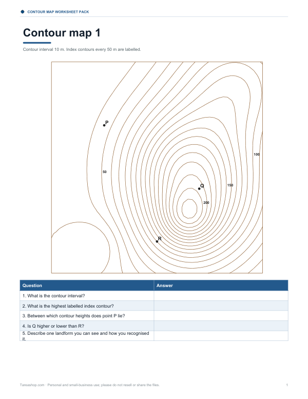 Contour Map Reading Worksheets
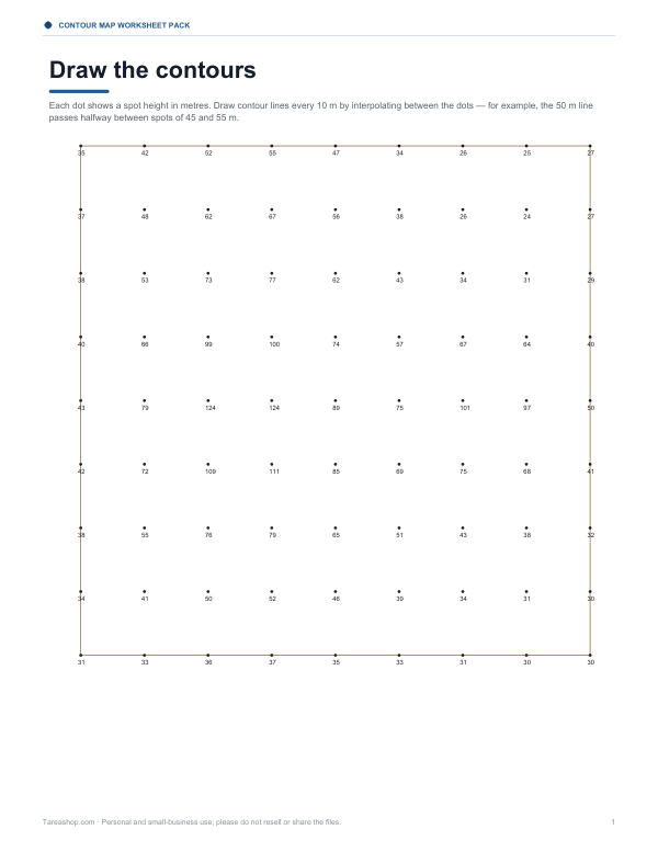 Contour Map Drawing Worksheet
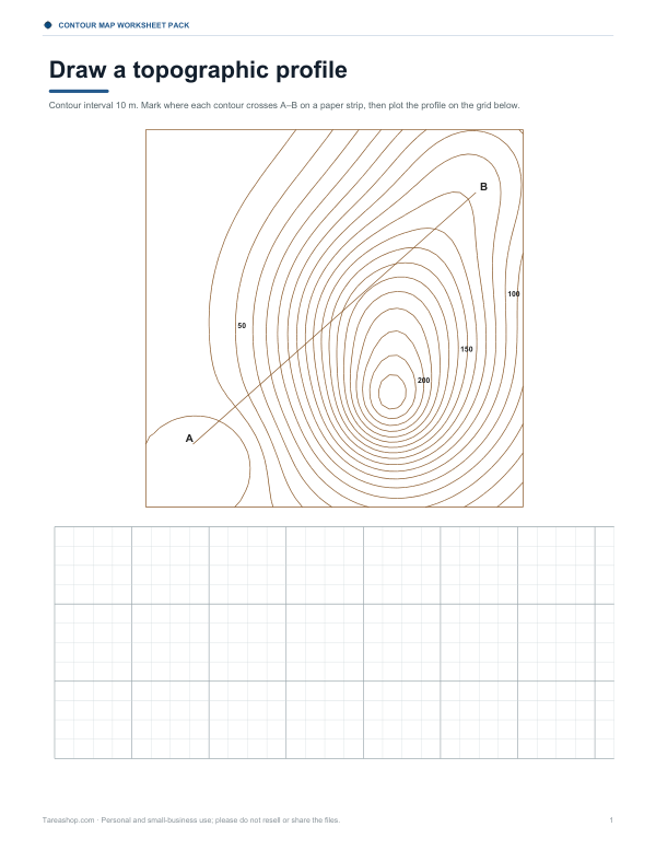 Printable Contour Profile Worksheet